Partners: Stiftelsen Norsk Institutt for Luftforskning, Norwegian Institute for Air Research
Climate change poses several challenges to European cities, such as droughts, urban heat waves, changing precipitation patterns, floods and (peri-)urban biodiversity loss. These impacts are interrelated with multiple factors such as land use activities around cities and the local socio-economic setting. Large datasets on these factors are available, but they are complex to integrate and analyze due to their different sources, formats and quality. Data cubes and the integration of data therein allow to assess their relationship.
The primary goal of UC1 is to furnish stakeholders from European institutions (policy makers, urban planners and NGOs) with a comprehensive “toolkit,” to make well-informed decisions to address the multifaceted impacts of climate change. We will perform a cluster analysis of EU cities using data from the climate, land cover/land use and socio-economic domains (see figure). This initiative will be executed on dual fronts: at the European level, encompassing approximately 800 cities, and at the local level, involving a focused approach on selected few test cities.
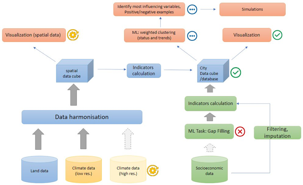
The analysis allows to identify cities with similar characteristics, assess different climate change impacts across the continent and the influence of different factors on cities adaptation capacity. It can also help identify positive examples and best practices which could inspire other cities. The created information can be provided in a tailor-made format such as short factsheets and visualizations for non-technical users or more specific maps, visualizations and even the underlying data for researchers or data engineers.